Sunday, July 30, 2006

Vicksburg Street

Like Fair Oaks and Chatanoonga, Vicksburg was named when Civil War battles were still fresh in the memory.

At 5 blocks in length, Vicksburg is just at the outer limits of Little Streets, but it's not a thoroughfare to anywhere, and anyway, I just like it.

For my favorite bit, turn uphill from 24th St. (Noe Valley's main drag) at the corner with the Phoenix Bookstore, and continue one short block till you get past Elizabeth--you won't notice the hill, as you'll be stopping so frequently to ooh and ahh. When you reach the top (actually the beginning) of Vicksburg, peek downhill on 22nd Street – one of the city of hills’ steepest paved hills (over 30% grade, or so they say). Climb the sidewalk-stairs down to Church Street for the views, climb back up to Vicksburg for a short aerobic workout.

(Map)

Saturday, July 29, 2006

Ecker


A lunch-time park sits on Market Street, right where Ecker Place began at the turn of (the previous) century. One Ecker is now a block in, at Stevenson. Ecker now--as then--continues past Jessie and Elim to Mission Street where it stops without ceremony.

The immediate-post-fire building at One Ecker is your classic unreinforced masonry building (or UMB, as they say in the trade)--rows of pretty red brick lined up side-by-side, with every 5th or 6th row being end-to-end. Its deep-set windows give another clue that it's UMB. Of course now you can see the external steel bolting that attaches floors to walls, and the internal cross-bracing -- evidence of more recent (probably post-Loma Prieta) earthquake retrofitting. As charming as it is, don't be fooled by the retrofit: in a really good jolt, the building won't collapse catostrophically, but it is likely to throw its brick facade off into the middle of Ecker and Jessie and Stevenson. (In a really good jolt, if you're inside, stay inside; if you're on the street, cozy up next to a building so that the bricks fall past you.)

Across from One Ecker is a skyrise--sit inside or out here, and emjoy Yank Sing's sweet and savory dim sum offerings. Or, walk a few steps south to the building that once housed Swallow. I haven't tracked the story of Swallow Printing, but this plaque hints at bits of nostalgia from the building that now. Just a bit further along Ecker is a lovely park (the fountain burbles weekdays, is quiet on weekends), and then you pass the eminently forgettable (if I didn't keep reminding you) Elim Street, then a cyclone-fenced empty lot.

(Map)

Thursday, July 20, 2006

Ramona Avenue


Right in the heart of the Mission district’s 16th Street corridor, is a one block-long street filled with small single family row houses, and with the high-falutting title of Ramona Avenue.


It would seem that one Mr. Andrew Thompson created Ramona in the post-fire days to spread his wings and mark his territory on the block bounded by 15th, Dolores, and of course, Ramona. Mr. T had made his first fortune in gold, then invested it in this plot of land. In 1852, he built his second fortune at his popular saloon fronting on 15th Street here, near the old Mission chapel. With the proceeds from his second fortune, he built himself a large brick home next door, and added a grocery store to the saloon.

All was apparently fine on April 17, 1906, and all was apparently destroyed by April 21. (We don’t know for sure but the brick structure was a likely victim of dynamiters creating a firebreak that would save the mission chapel.)

Immediately post-fire, Mr. T. purchased a home then located on Haight St, and had it transported to the then-vacant land. This large Italianate now sits amidst gardens at 1876 15th St. So, what of Ramona? Rental housing was in high demand after the 1906 fire destroyed 28,000 buildings and left some 250,000 homeless. Sounds like Mr. T. was financially astute, and created a sort of income-producing fence along the edge of his property: a row of rental houses.

As for the name… hard to say. Lots of the little streets are named for women. Perhaps this little street was named for the lead in Helen Hunt Jackson’s popular story of mission days.

(Source on Mr. T and 1876 15th is the Junior League of San Francisco’s book, Here Today.)

(Map)

Monday, July 17, 2006

Lexington


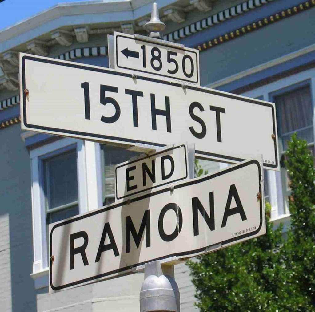
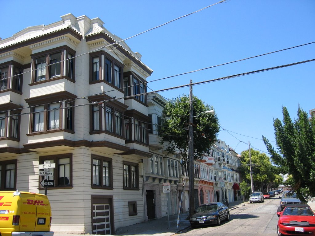
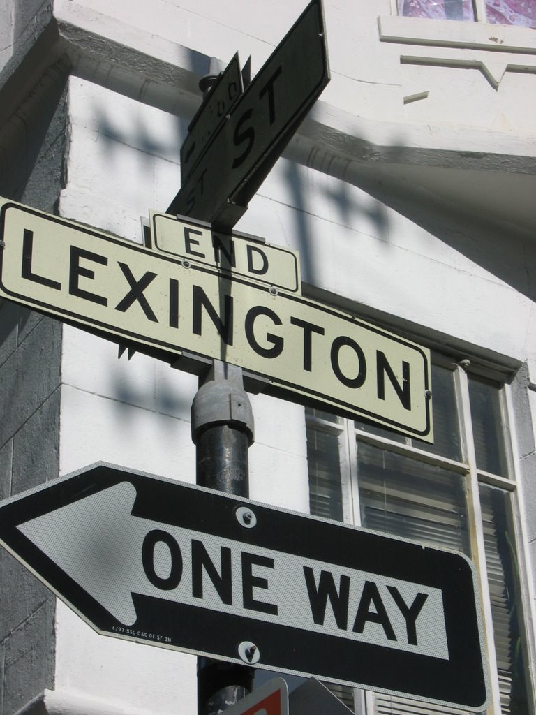
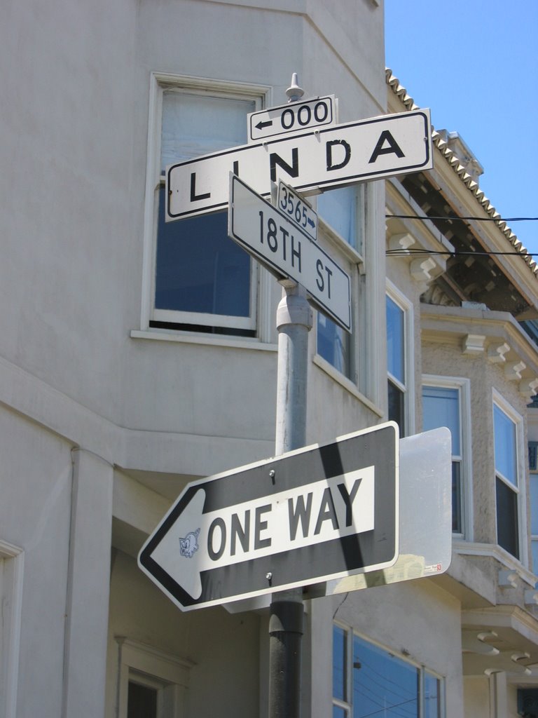
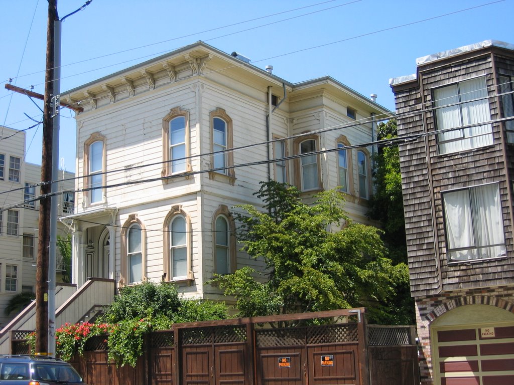
The houses along the Mission district’s Lexington Street (then called Stevenson) sprang into existence in 1876 – the work of real estate builder-developers The Real Estate Associates or 
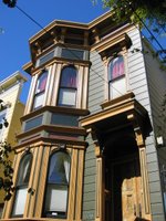
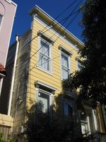
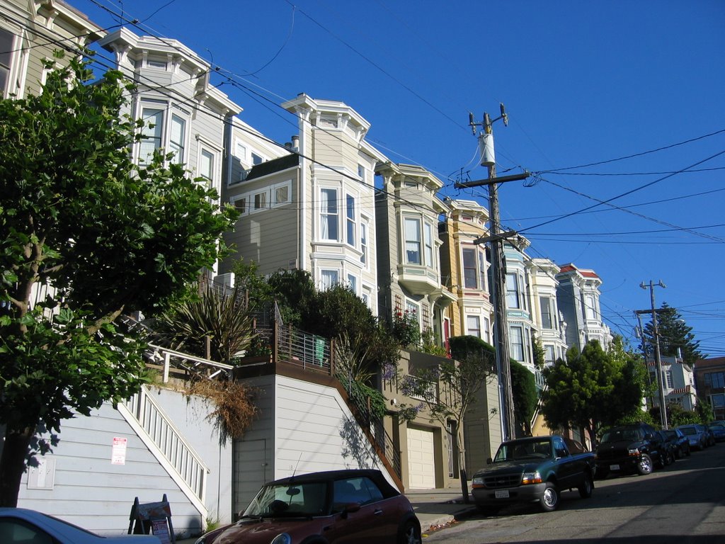
TREA. Not the mansions of Nob Hill, Pacific Heights or Upper Van Ness, not even the single-family architect-designed homes along Liberty Street (around the corner), the TREA homes on Lexington were tract houses. Here, TREA bought a whole city block (or 2) and created two streets between Valencia and Mission so they could cram in lots as small as they figured the market would bear.Slight variations on the windows and façade distinguished one house from another.

According to the 1880 census, when Lexington was still new, 27-year-old barber Valentine Meinberger lived here with his wife and infant daughter. A corner building was home to two households: 29-year-old letter carrier Austin King lived with his wife Delia in one flat, 24-year-old John Wilkins lived with his 19-year-old wife, daughter and younger brother—the two boys ran the downstairs store. Their neighbors along the street included more letter carriers, a music teacher, a post master, an engineer, a carpenter, and a dentist. Most were young families with newborns, toddlers or school-aged kids.

(If you're curious about a specific family, or address, send me a comment and I'll see if I can track down a detail or two to delight you.)

Today, this old tract neighborhood is a delightful, tree-lined oasis from the bustle of the nearby major thoroughfares. The trees have grown up now but 125 years later, Lexington Street still provides “affordable” housing (within reason, of course—this is, after all, San Francisco!) with easy access to great restaurants along Guerrero and Valencia.

(Map)

Saturday, July 15, 2006

Maiden Lane

In the 19th century, this was Morton Street, variously considered the vilest, or the second vilest street in San Francisco. (Chinatown’s Waverly place provided the principal competition). Topless harlots leaned from their casement windows, luring business from the men who passed by. On a slow night, a woman’s pimp sold fondles for the standard price: 1 breast for ten cents, 2 for fifteen.

After the 1906 fire, Morton Street’s former tenants moved their business elsewhere, and the increasingly upscale merchants in the Union Square neighborhood renamed this Union Square Avenue. In the early 1920s, a local diamond merchant won city approval to rename the street again, this time for the jewelry district Maiden Lanes of London and Paris. And thus, with no apparent nod to irony, Morton Street completed its transformation.

Juicy stories set in or near Maiden Lane abound. For more, you might want to join me or one of the other San Francisco City Guides on our Monday morning “Bawdy and Naughty” walking tours.

(Map)

Mark Twain

At one block, plus one and a half blocks (punctuated by the Transamerica Pyramid) you’d think Merchant Street was already short enough. But no. The part that starts at the redwood grove on the east side of the pyramid has to share its generic mercantile name with the way-funnier Mark Twain. (Map)

Why Mark Twain?

The story goes back to the steam baths that used to be in the basement of the Montgomery (Monkey) Block. The Monkey office block filled the space between Montgomery St and Sansome, and Washington and Clay, was built in 1853, just as San Francisco recovered from the gold rush. The structure survived the fires of the 1850s, and those of 1906 (the interior burned in 1906 but the building itself was reusable). In fact, the Monkey Block survived until the 1959, when a developer tore it down and put in a parking lot. (We were into modern then.) A few years later, Transamerica replaced the parking lot.

So what does Mark Twain have to do with steam baths and the Monkey Block? The story goes like this: a young Mark Twain met a fireman one day while the 2 were sitting steaming in the basement baths. The fireman’s name was Tom Sawyer. No one knows/cares what became of the fireman but we all know what became of the name.

And, while we’re at it, here’s another Monkey Block story… An Italian restaurant there, Coppa’s, had at first catered to the upscale businessmen who worked in the upscale offices in The Block; then as Block got older, and the upscale offices moved out and more and more bohemians/artists/writers moved in, Papa Coppa increasingly fed the artistic crowd—fed them well when they had just made a sale, fed them anyway when they were between commissions/sales. In return for Papa C’s generosity, artists painted a mural on first one wall, then all the walls of the dining room. Apparently quite something—filled with visual gossip and risqué portraits—so much something that it became a tourist draw and kept the Coppa’s tables full. Then the earth shook and fire swept through. After the fire, soldiers enforced a dusk-to-dawn ban on inside fires (stoves, fireplaces, even candles were banned). Soldiers also patrolled to keep looters from looting downtown banks and businesses.… But a few soldiers couldn’t keep a few determined writers from their old haunt. When they snuck in one night (and brought their own wine and comestibles, which perhaps they shared with the guards), they had themselves a candlelit celebration. They celebrated having survived, and that their friends survived. They also celebrated the ashes of manuscripts that had been sent out for publication repeatedly and met with rejection just as repeatedly—they were now free from the old burdens and could move on. Or so the story goes.

Thursday, July 13, 2006

Dearborn to (Humming)Bird

Two streets so tiny you'd almost miss them if they weren't so near the brilliance of the Women's Building murals. (Map)

Dearborn connects with neither Lapidge nor Linda, although it starts right across 19th from them. You first come to a lovely private garden, fenced, I'm sure, to distinguish it from the lovely community garden right across the street, at the corner of Bird.

Dearborn supports only one-way traffic but Bird, such a tiny snippet of a street it might be renamed Hummingbird, supports next to no traffic at all. Bird doesn't last half a block, as if the delight of its name can hardly keep it grounded.


Linda


And, parallel to, and immediately west of, Lapidge is Linda…

Linda – meaning in Spanish (you know, Mi Cielito Lindo) – didn’t exist in 1898, and (judging by the architecture) probably not until the 2nd or 3rd decade of the 20th century. Instead, what is now the 100 block of Linda was, in 1898, Angelica Street, running 2/3 of a block south from 19th, just past Cumberland Place (which now deadends in the park).

Rumor has it that Tessie Wall--San Francisco's most famous and beloved early 20th century madam--grew up in this neighborhood, and retired here when she got out of "the business" in the 1920s.

(Map)

At #124 lies one house—actually part of a house (marketed as a TIC)—on sale for $489,000. The Edwardian building dates to the post-fire era (1908). For photos and details, check out: B.J. Droubi - 124 Linda.

Tuesday, July 11, 2006

Lapidge


In the Mission district, Lapidge is best known for sneaking up next to the spectacular mural that wraps around the Women’s Building on 18th Street. Stroll the quiet block that is Lapidge and lull into calm until you hit the shock waves of brilliant orange, yellow, blue swirls around Surgeon General Joselyn Elders, Nobel Peace Laureate Rigoberto Menchu, the Chinese goddess of mercy Quan Yin, the African slaves’ goddess of the sea Yamenja. Painters created the mural to celebrate paying off the mortgage on the building. They chose the medium of a mural to celebrate the neighborhood’s Mexican heritage. They chose the the theme of powerful women through time and across cultures to celebrate feminine strength and vibrancy.
(Map)

Of course Lapidge didn't pop into existence in some sort of recent birthing ceremony. It shows up in city maps from 1898. And, folks have been living along Lapidge for a hundred years or more before the Women’s Building existed.

o On December 15, 1902, starting at 2:30, Isabell Campbell, the widow of Irish native Francis Campell (from County Monaghan), gathered together friends and relatives at their home, 35 ½ Lapidge, to celebrate the life of Francis, who had died the day before. Three years and four months later, the Campbell residence was destroyed in the fire that swept the city after the 1906 earthquake. (Thanks to Susan Cherry-Boyer for the transcription of the death notice.)

o In 1922, number 63 Lapidge was home to Mrs. M. Fritz, or so it would appear from the 1922 edition of Who’s Who among the Women of California.

o And, in 2004, the 1908 Vic at 79 Lapidge sold in 2004 for $1.1m. A year later, its next door neighbor (77) was on the market for a mere $790,000.

Lapidge is not a common name. It isn't the name of a U.S. president or a Mexican settler. Where did it come from? Perhaps this short street was named for W.F. (or W.E.) Lapidge, the sea captain who sailed for the Pacific Mail Steamship Co. on the route between San Francisco and Panama in the 1860s (before the transcontinental railroad). (For more on Capt. Lapidge, see: Maritime Heritage, Transcriptions from the Sacramento Bee, and Docking of the Colorado.)

Friday, July 07, 2006

Elim


Do you know Elim Street? Elim meets the criteria for small. It's one block long, and you don't need to worry about being hit by a car here.

If you wanted to lay down sideways in Elim--no, on second thought, I wouldn't recommend such intimate contact with the pavement here (it's puddled in the winter, a little stinky when the homeless man has been staying there). Nothing elegant here. OK. So, instead, try standing in the center and sticking out your arms. You'll touch (unreinforced masonry) walls on either side. Basketball players are taller than Elim is wide. Nine of my shoes, placed toe-heel-toe-heel, will span the distance. To Market Street's 120-foot width, Elim is 7.

So how do you find Elim? Walk down 1st St from Market, past Stevenson, past Jessie, almost to the Mexican restaurant. On 1898 city maps, Elim wasn't called Elim at all. It was Lick Alley (but the footprint was the same). Sometime in the century since, the Lick name was transfered to the more important non-passageway of what is now the Crocker Galleria, sitting between Post and Sutter, just up from Market Street. (Map)

I don't know when Lick became Elim, or which Elim it was named for but I'm on the hunt... If you find out before I do, please send a comment.