Showing posts with label San Francisco. Show all posts

Monday, April 23, 2007

Gold


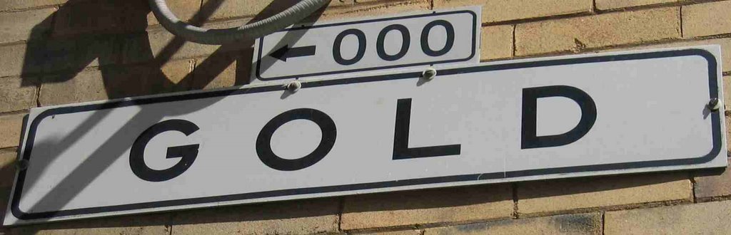
In 2006, it's at the edge of the Jackson Square Historic District, during gold rush days, Gold Street was at water's edge.

1849. Gold rush days... Gold Street. Makes sense. This was the home of gold assayers, evaluating the miners' dust and nuggets.

Gold is a sweet little street. Generally no traffic at all. (But of course today, while I was leading a group of 17 walkers along Gold, an Ecolab truck drew near. We jumped from the middle of the street to the sidewalk. Then Ecolab paused, stopped, turned off the engine and the driver left the van and went inside one of the generally closed doors.... Coincidence and San Francisco traffic ruled the next event: within moments another van pulled up behind Ecolab. Van #2 had no apparent business on Gold, but instead believed this would be a cool little shortcut between Sansome and Montgomery. I didn't hang around to watch and wait for this little San Francisco traffic drama to play itself out.)

A few doors open on to Gold but the only sign to indicate commercial activity is the sign for Bix, a jazz-supper club that Playboy magazine is reported to rate as among the top bars in the country. My my. Oh, yes. And, Bix is in one of the few downtown buildings that survived the 1906 earthquake and fire, possibly a building where gold was assayed, and now an historic landmark.

(Map)

Hotaling Place


If, as they say, God spanked the town for being over frisky,
Why did He burn the churches down and save Hotaling's whiskey?

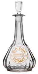
In April 1906, fire —and dynamite— took down most of San Francisco from the Mission District to the northern waterfront and from the Bay to Van Ness. A total of 28,000 buildings were lost. A few pockets inside the burned district were saved due to the whimsey of wind and flame, or local heroism. Hotaling's was the savior of this particular pocket, that is now called Jackson Square.

Here's the story: the Army wanted to dynamite the Jackson Street buildings,
including Hotaling’s, to create a firebreak to save the nearby U.S. Appraiser’s Building. However, as the Hotaling’s manager pointed out, a few sticks of dynamite, the woodframe building and the 5,000 barrels of Old Kirk whiskey stored inside would have created rather more firestorm than firebreak. (Some say an exchange of gifts of cash or alcohol may have facilitated the decision.)

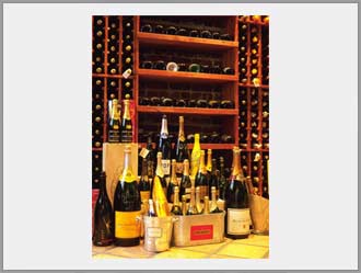
The little street named for Hotaling’s started life as Jones Alley. Close to the original waterfront, Jones Alley served the function of an alley: the service entrances to nearby businesses, a place where freight conveyances (carts and wagons), drawn by (manure-producing) horses could wait for pickups and deliveries out of the way of more proper traffic along the more major thoroughfares. For many years in the last decades of the 1800s, I. Landsberger & Co. champagne manufacturers and distributors were open for business at 10 and 12 Jones, right about where the Bubble Lounge is today.


In 1903, Jones morphed into Jessop. (Perhaps commemorating New York native Andrew Jessop, a manufacturer of spices… more research needed to get the scoop on why the name changed.)

Jessop remained Jessop through the pre-fire boom, the fire itself and the post-fire reconstruction. It remained Jessop through the mighty days of the Barbary Coast, and through the (relative) clamp-down of Prohibition. Then, along about the time that the 18th Amendment (banning the manufacture, transportation and sale of alcohol) was repealed, Jessop Alley became Hotaling St. The timing may have been a coincidence.

(In commemoration of 100 years since Hotaling's heroism, San Francisco's Anchor Brewing Company has created a new Hotaling's Whiskey.)


(Map)

Thursday, August 24, 2006

Grand - Grace

Nineteenth Century Grand Avenue. Or, more accurately, Grandiose. It’s an alley, and it only lasts one block. In fact, it’s one of two alleys (along with Washburn) that slice through the block from 9th to 10th, and Mission to Howard.

(Since the great street renaming around 1909, Grand lost some of its grandeur with a new name: Grace—which is still a touch high-falootting for such a modest alley.)

Number 35 Grand Avenue was home to the O'Brien family in 1906. 13-year old James Joseph O’Brien, his older brother Milton and their parents rented the 3-story wood-frame flat for $18 a month, sub-letting the top story to the engineer of the bath house across the street and the engineer’s wife. (The sub-renters paid the O’Briens $18/month, thus offsetting the cost nicely).

In pre-fire-quake days, Jim and his family shopped around the corner on 9th street. (Five cents for a loaf of bread, a dozen donuts for a dime. The butcher gave them free liver for the cat and knuckle bones for the soup.)

The first jolt that Wednesday morning on April 18 caused Grand Avenue’s wood-frame houses to dance a nice shake-rattle-and-roll. When the music was over (45 seconds after it started), the houses readjusted themselves and returned to their original upright, standing positions. But, while redwood sways nicely when it needs to, brick chimneys don’t. Showing little grace, the chimneys toppled, as did the contents of the kitchen- and medicine-cabinets.

But don’t worry about Jim and his family. Fire did wipe out their flat but not until many hours later—plenty of time to move their belongings south out to Potrero and Oakdale. And, the family had insurance with Liverpool, London and Globe, which paid sufficiently that the O’Briens could put up a pre-fab house with funds left over for a 14-person burial plot at Holy Cross Cemetery.

(Mr. O’Brien’s reminiscences were published in a now out-of-print volume called 1906 Remembered.)

Wednesday, August 16, 2006

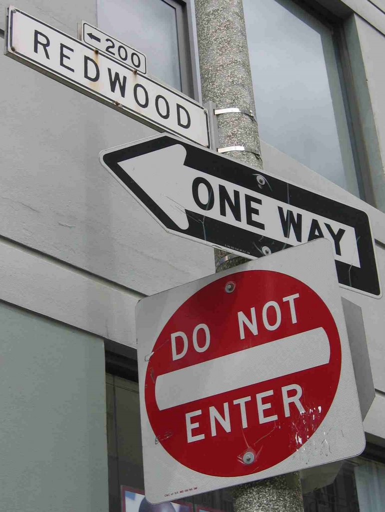
Redwood


Redwood is one of the tree-plant streets (Ivy, Lily, Hickory, Linden, Rose, Olive, Birch, Myrtle…) that used to run--and now skip--through Hayes Valley.

These were always narrow—the kinds of streets where the rich certainly wouldn’t live but their hired help would frequent. While narrow, they were long: 6 or 8 blocks or more. But they were still little enough not to be taken seriously, and easily erased when more important buildings were to be built (City Hall, St. Ignatius College, Mechanics Pavilion, Commerce High School, and later Davies Symphony Hall, War Memorial Opera House, the state building, and so many more).

Redwood and the others have survived into the 21st century in bits and starts. Snippets of Redwood exist as deadends west from Laguna, east from Franklin, and for a block-long shady stretch between Van Ness and Polk (shady, not from redwood trees, but from the highrise public buildings on either side). Along this shady corridor, you can now find the City Box office (seller of tickets to many cool local events), and the back door Trader Vic’s restaurant (home of the original Mai Tai, invented in 1944).

(Map)

Friday, August 11, 2006

Opera Alley

This post is a trick. You won’t find this little street any more. But, in the decades before the 1906 quake-fire, Opera Alley ran NW from Mission Street between 3rd and 4th, just next to the –then- Grand Opera House.

Famously, the world’s greatest tenor of the time (or of all times, by some accounts), Enrico Caruso sang Don Jose in Carmen at the Grand Opera House on Tuesday night April 18, 1906. Caruso was touring with the Metropolitan Opera Company here when the quake hit. Earlier in April, when the company was in Chicago, Caruso almost parted ways—Caruso intended to take the train back to New York, and then return to Italy (where the food was more to his liking). He intended to let the MOC end the tour without him. But, alas, Vesuvius started erupting, so Caruso continued on where he’d be safe.

The pre-dawn temblor woke Caruso, shaking him from his bed at the nearby Palace Hotel but not seriously damaging the building. Legend has it that he breakfasted heartily that morning at the nearby St. Francis Hotel on Union Square, but refused to return to the Palace. (He did send his butler back inside for Caruso’s eight trunks of personal items—that’s personal items, not costumes or sets or anything.)

The fires started slowly that morning but by mid-day the Opera House was eaten by flame, and by mid-afternoon, the Palace also succumbed. Caruso (along with his trunks) escaped the city, and kept his promise never to return.

Today, the Opera House is in Civic Center. What was Opera Alley in the 1890s until 1906, is now a cyclone-fenced construction pathway for the building of the Jewish Museum (projected to open in 2007).


(Map)

Saturday, August 05, 2006

Carlton Goodlett Place


Dr. Carlton B. Goodlett Place is and is not a little street. Hunh?

It's actually an aka for Polk Street, a north-south artery one block east of Van Ness. Huunnh??

Since 1915, San Francisco City Hall has found itself sandwiched between Polk and Van Ness, Grove and McAllister. None of these even remotely qualifies as a little street. Yet, since 1999, City Hall has enjoyed a little-street address. The part of Polk Street it faces is now Goodlett Place. All the glamour of a move, without all those pesky moving boxes, tape and disruption.

What gives? As they say on the official city website:

City Hall's official address is now 1 Dr. Carlton B. Goodlett Place. The two blocks of Polk Street in front of City Hall were renamed Dr. Carlton B. Goodlett Place in honor of Dr. Carlton B. Goodlett, the late local civil rights leader, community activist, physician and publisher. Dr. Goodlett was the publisher of the Sun Reporter newspaper, and served as the president of the San Francisco branch of the National Association for the Advancement of Colored People. The official renaming ceremony took place on the anniversary of Martin Luther King Jr's birthday, January 18, 1999.

What the official website doesn't say is that Dr. Goodlett's community activism centered on the fight with City Hall and the federal government to include Fillmore neighborhood residents in planning for the future of their neighborhood. Alas, before locals could speak, wrecking balls had destroyed not only the delapidated housing but also the clubs and businesses that were home to a vibrant jazz scene. (It took years before new housing replaced the old, and by then much of the old spark was lost.)

(Map)

Wednesday, August 02, 2006

Daniel Burnham

Daniel Burnham? But he’s from the Midwest. What’s he doing in San Francisco?

With a whopping 50 years of statehood under its belt, early 20th century San Francisco was the biggest port, the biggest industrial center, and in fact the biggest city on the west coast. Nearly half a million people were San Franciscans (up from around 500 in the 1840s). Former mayor James Phelan and other civic boosters wished to bask in the proper international recognition of our greatness. In 1903, they hired the world’s greatest urban planner (Daniel Burnham) to show us how to make San Francisco the Paris of the Pacific.

When it was unveiled, six months before the great quake-fire of April 06, Burnham's plan was clearly too costly to implement. Too many buildings would need to be destroyed in order to create the broad Champs Elysees-like avenues, the spiraling roads that would climb the hills, the grand amphitheatre and parks.

But then, voila, the city burned down. 28,000 buildings were destroyed. The perfect opportunity to start over from scratch, right? Wrong.

Each day needed for construction, was a day that businesses weren’t earning income. Private parties needed to rebuild ASAP. The city’s tax base was destroyed (and the credibility of its politicians was in the basement—but that’s another story for another day). With a reduced city budget, public projects were out of the question. Burnham’s plan was largely ignored.

But the plan had its merits, apparently sufficient merits for Mr. Burnham’s name to grace this little street. (Actually, San Francisco’s civic center—combining politics and the arts—was the one part of the plan that we followed. Thus, it's not incorrect the D. Burnham Ct. should be near civic center.)

(For a great bio of Burnham, check out the New York Times bestseller Devil in the White City—author Eric Larson manages to transform a rather dull topic (project management for the 1893 Chicago World’s Fair) into a fascinating page-turning read, by juxtaposing Burnham’s story with the nationalenquireresque but true story of contemporary serial killer Herman Webster Mudgett, aka H. H. Holmes.)

(Map)

Tuesday, August 01, 2006

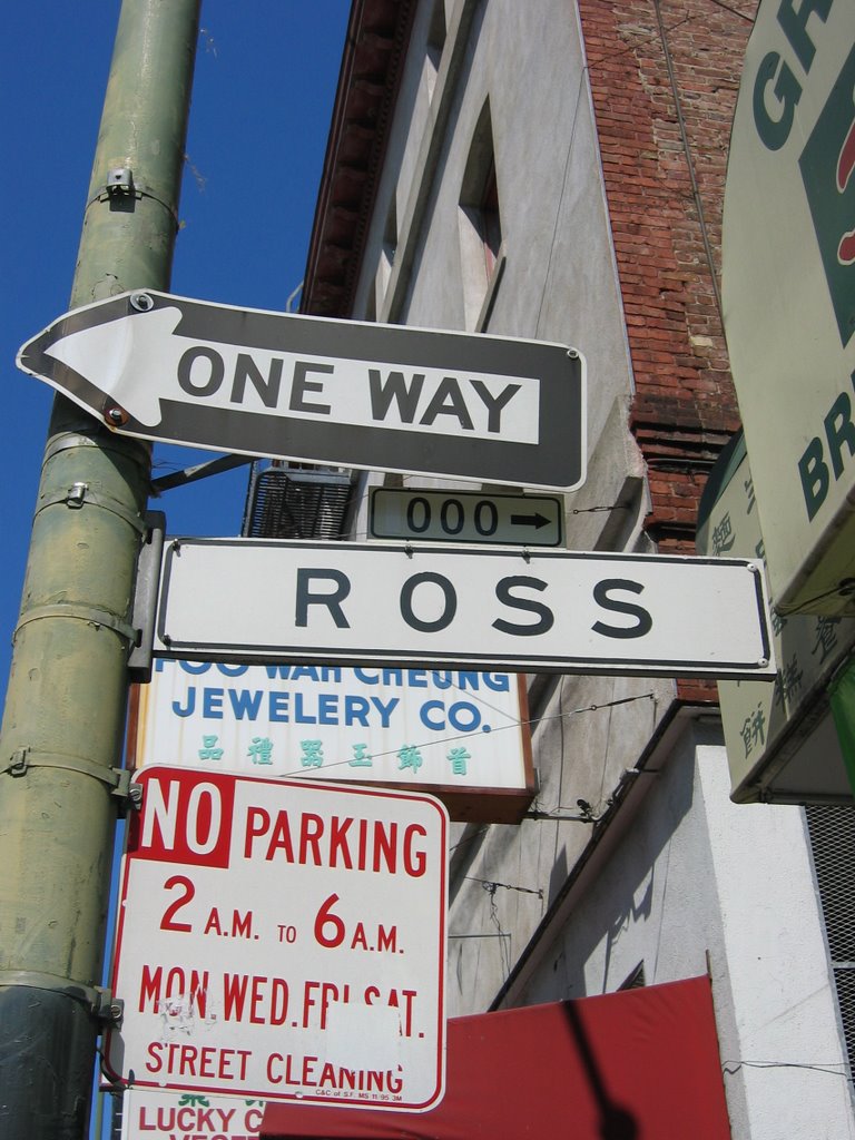
Ross Alley


Now home to the Golden Gate Fortune Cookie Company, a musical barber, and a brass plaque-map of the alleys of Chinatown, Ross Alley’s bustling present is a very long walk from its dark past.

Photographer Arnold Genthe captured Ross as the street of the gamblers. (Genthe would spend hours standing in Chinatown’s doorways, until his subjects bored of his Caucasian face, and then he took photo after photo of this exotic city within a city. When his subject matter didn’t appear sufficiently exotic, Genthe touched up the negatives in his lab before creating a final print.)

In 1880, national census-takers walked the alley, knocking on door after door. They found houses of Chinese boarders living next door to store keepers, tailors, cigar makers, seamstresses and cooks along this alley, then called Stout.

(Map)

Sunday, July 30, 2006

Vicksburg Street

Like Fair Oaks and Chatanoonga, Vicksburg was named when Civil War battles were still fresh in the memory.

At 5 blocks in length, Vicksburg is just at the outer limits of Little Streets, but it's not a thoroughfare to anywhere, and anyway, I just like it.

For my favorite bit, turn uphill from 24th St. (Noe Valley's main drag) at the corner with the Phoenix Bookstore, and continue one short block till you get past Elizabeth--you won't notice the hill, as you'll be stopping so frequently to ooh and ahh. When you reach the top (actually the beginning) of Vicksburg, peek downhill on 22nd Street – one of the city of hills’ steepest paved hills (over 30% grade, or so they say). Climb the sidewalk-stairs down to Church Street for the views, climb back up to Vicksburg for a short aerobic workout.

(Map)

Saturday, July 29, 2006

Ecker


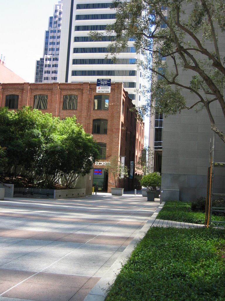
A lunch-time park sits on Market Street, right where Ecker Place began at the turn of (the previous) century. One Ecker is now a block in, at Stevenson. Ecker now--as then--continues past Jessie and Elim to Mission Street where it stops without ceremony.

The immediate-post-fire building at One Ecker is your classic unreinforced masonry building (or UMB, as they say in the trade)--rows of pretty red brick lined up side-by-side, with every 5th or 6th row being end-to-end. Its deep-set windows give another clue that it's UMB. Of course now you can see the external steel bolting that attaches floors to walls, and the internal cross-bracing -- evidence of more recent (probably post-Loma Prieta) earthquake retrofitting. As charming as it is, don't be fooled by the retrofit: in a really good jolt, the building won't collapse catostrophically, but it is likely to throw its brick facade off into the middle of Ecker and Jessie and Stevenson. (In a really good jolt, if you're inside, stay inside; if you're on the street, cozy up next to a building so that the bricks fall past you.)

Across from One Ecker is a skyrise--sit inside or out here, and emjoy Yank Sing's sweet and savory dim sum offerings. Or, walk a few steps south to the building that once housed Swallow. I haven't tracked the story of Swallow Printing, but this plaque hints at bits of nostalgia from the building that now. Just a bit further along Ecker is a lovely park (the fountain burbles weekdays, is quiet on weekends), and then you pass the eminently forgettable (if I didn't keep reminding you) Elim Street, then a cyclone-fenced empty lot.

(Map)

Thursday, July 13, 2006

Dearborn to (Humming)Bird

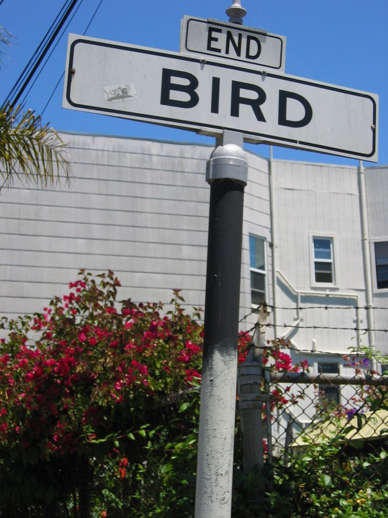
Two streets so tiny you'd almost miss them if they weren't so near the brilliance of the Women's Building murals. (Map)

Dearborn connects with neither Lapidge nor Linda, although it starts right across 19th from them. You first come to a lovely private garden, fenced, I'm sure, to distinguish it from the lovely community garden right across the street, at the corner of Bird.

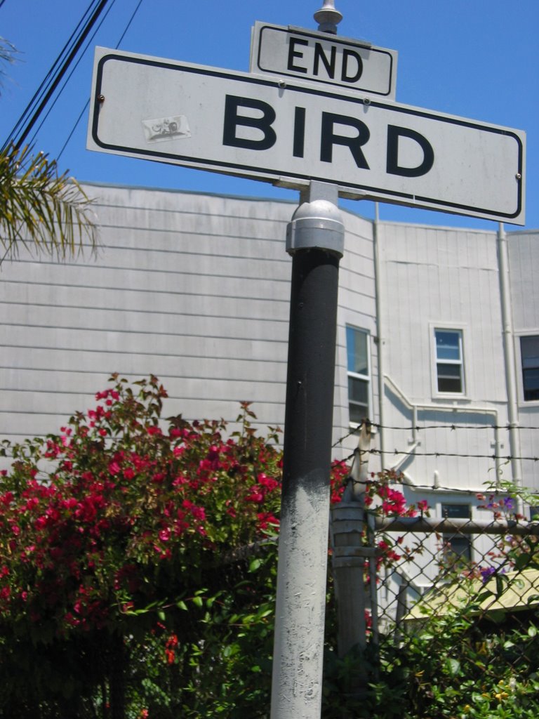
Dearborn supports only one-way traffic but Bird, such a tiny snippet of a street it might be renamed Hummingbird, supports next to no traffic at all. Bird doesn't last half a block, as if the delight of its name can hardly keep it grounded.


Linda


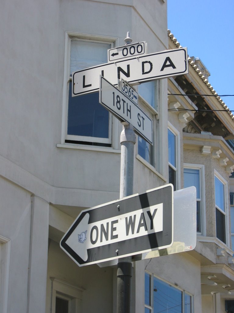
And, parallel to, and immediately west of, Lapidge is Linda…

Linda – meaning in Spanish (you know, Mi Cielito Lindo) – didn’t exist in 1898, and (judging by the architecture) probably not until the 2nd or 3rd decade of the 20th century. Instead, what is now the 100 block of Linda was, in 1898, Angelica Street, running 2/3 of a block south from 19th, just past Cumberland Place (which now deadends in the park).

Rumor has it that Tessie Wall--San Francisco's most famous and beloved early 20th century madam--grew up in this neighborhood, and retired here when she got out of "the business" in the 1920s.

(Map)

At #124 lies one house—actually part of a house (marketed as a TIC)—on sale for $489,000. The Edwardian building dates to the post-fire era (1908). For photos and details, check out: B.J. Droubi - 124 Linda.